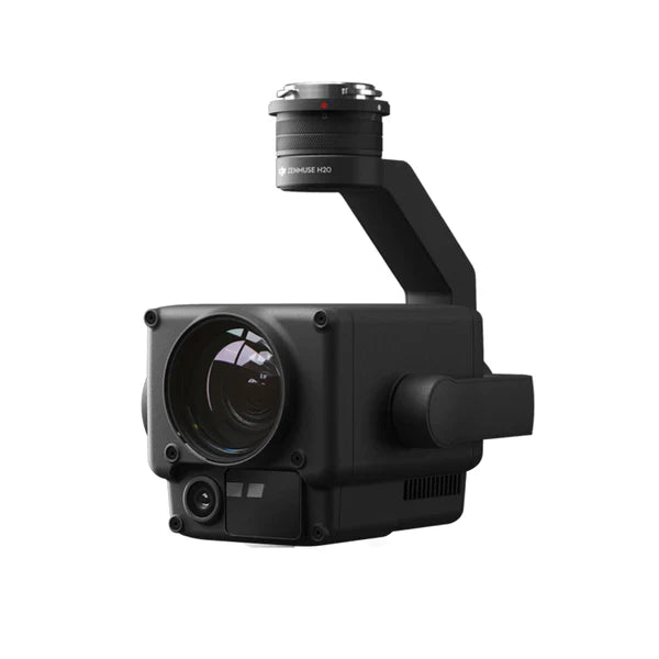
DJI Zenmuse H20 Payload
✔ Price Match Guarantee
✔ Ships in 1-2 Business Days
✔ Unlimited After-Sales Support
Phone: +1 888 850 6533
Mon - Fri: 9 am - 5 pm (MT)
Phone: +1 888 850 6533
Mon - Fri: 9 am - 5 pm (MT)

✔ Price Match Guarantee
✔ Ships in 1-2 Business Days
✔ Unlimited After-Sales Support
The DJI Zenmuse H20 is DJI's hybrid sensor solution, designed as a payload for DJI Matrice 350 RTK. This payload has aerial surveying and inspection capabilities. As DJI's first triple sensor payload, the H20 melds high-resolution imaging, extensive zoom capabilities, and precise laser range into a fully integrated package,
Wide Camera: Equipped with a 12 MP 1/2.3" CMOS sensor and a 24mm focal length lens, it captures expansive views with an 82.9° DFOV, ideal for initial area assessments and broad scene captures.
Zoom Camera: A 20 MP 1/1.7" CMOS sensor paired with a 23x hybrid optical zoom and a staggering 200x maximum zoom capability allows for detailed examination of specific areas or objects from a safe distance, making it perfect for intricate surveying and inspection tasks.
Laser Rangefinder: With an impressive range of up to 3/4 mile (1200m), the laser rangefinder measures distances accurately, providing vital data such as the distance from the aircraft, relative height, and GPS coordinates of the targeted object. This feature is indispensable for applications requiring precise location and measurement information, including search and rescue, infrastructure inspection, and environmental monitoring.
IP44 Rating: The H20 is built to withstand harsh environmental conditions, ensuring reliable operation in both dusty environments and light rain, with an operating temperature range of -4°F to 122°F.
Active Image Stabilization and EIS: Provide smooth, clear imagery even in windy conditions or when maneuvering, enhancing the quality of the collected data.
Night Scene Mode: Enhances the capture capabilities in low-light conditions, extending the operational window into the night and allowing for 24/7 operation.
Click to Aim: Simplifies the process of pinpointing interest areas by allowing operators to double-click on the desired point on the controller screen, automatically aligning the camera/gimbal to the selected location.
Smart Track: automatically identifies and follows moving subjects with the auto-zoom function, continuously updating the subject's location, making it ideal for dynamic monitoring tasks.
High-Res Grid Photo: Takes a comprehensive overview photo with the wide camera, then captures detailed 20 MP images of the area using the zoom camera. This function is crucial for surveyors and inspectors, who require both a broad operational perspective and the ability to focus on specific points of interest with high resolution.