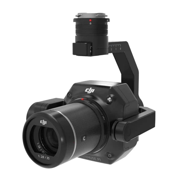
DJI Zenmuse P1 Payload
✔ Price Match Guarantee
✔ Ships in 1-2 Business Days
✔ Unlimited After-Sales Support
Phone: +1 888 850 6533
Mon - Fri: 9 am - 5 pm (MT)
Phone: +1 888 850 6533
Mon - Fri: 9 am - 5 pm (MT)

✔ Price Match Guarantee
✔ Ships in 1-2 Business Days
✔ Unlimited After-Sales Support
The DJI Zenmuse P1 is aerial surveying technology what can be utilised by surveyors and construction professionals to aid in site mapping and inspections. Compatible with the DJI Matrice 350 RTK, this full-frame sensor camera is equipped with a 45 megapixel sensor and advanced features for photogrammetry and surveying. Efficiency using this payload has a huge advantage over traditional surveying methods.
Exceptional Image Quality: The P1's 45 MP full-frame sensor captures ultra-high-resolution images, enabling detailed and precise photogrammetry outputs. The 4.4μm pixel size means that even the minutest features are sharply defined, enhancing the quality of the survey data.
Surveying Accuracy: Achieve accuracy without the need for Ground Control Points (GCPs) — 3 cm horizontally and 5 cm vertically, reducing the need for on-ground surveying work and speeding up the data collection process.
Interchangeable Lens System: Utilizing DJI's DL mounting system, the P1 offers flexibility in lens selection, allowing surveyors to tailor the camera setup to specific project requirements, optimizing both range and detail capture.
Advanced Stabilization and Capture: The 3-axis stabilized gimbal supports Smart Oblique Capture, automatically adjusting the camera angle to capture the most informative aspects of the terrain, ensuring comprehensive coverage and detail in every shot.
Global Mechanical Shutter: With a shutter speed of 1/2000 seconds, the P1's global mechanical shutter minimizes motion blur and rolling shutter effects, crucial for capturing clear, consistent imagery in dynamic flight conditions.
High-Efficiency Coverage: Covering up to 3 km² in a single flight, making the Zenmuse P1 an ideal choice for large-scale surveying projects. This high efficiency significantly reduces the time and costs associated with aerial survey missions.
Enhanced Operational Time: The low-noise, high-sensitivity sensor of the P1 extends operational times by allowing for high-quality image capture even in low-light conditions. This feature is invaluable for projects with tight deadlines or limited daylight hours.
Rapid Image Capture: Capable of taking a photo every 0.7 seconds during flight, the P1 maximizes data collection speed without compromising image quality, enabling fast-paced surveying that keeps projects on schedule.
TimeSync 2.0: This feature provides microsecond-level synchronization between the camera, flight controller, RTK module, and gimbal, guaranteeing that all data captured is precisely aligned and time-stamped for maximum accuracy and efficiency in post-processing.